A simple tool to assist with Route Planning
I’ve had problems before where I am trying to get to a number of different sites and I want to easily have all the locations available to me on my phone with proper navigation through google maps if I need it – either by car, public transport or as a pedestrian/cyclist.
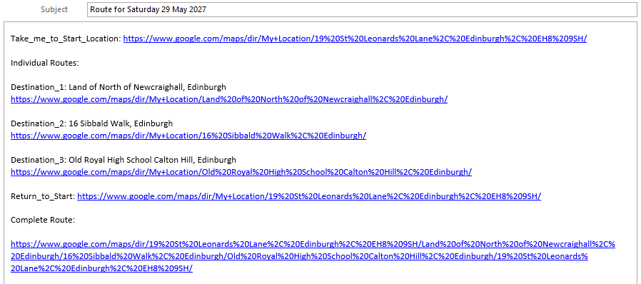
Here is a worked example lets say you are in Edinburgh and you would like to find your way round three development sites starting and ending at the Holyrood Distillery. I created and hosted a simple HTML and Javascript tool which I can use at work or home to plan routes around sites and then if needed allow me to email created routes for later use. This stores variables in URLs which can be passed to Google Maps. These can be stored in emails and accessed from a mobile when out and about. It uses the existing Google Maps API. In the example we start from Holyrood Distillery at 19 St Leonard’s Lane, Edinburgh, EH8 9SH and then head out to Land North of Newcraighall / Edinburgh before going to 16 Sibbald Walk and then up to the Royal High School before heading back to Holyrood Distillery. These three sites are, at May 2025, either under construction or have recently obtained planning permission.
–

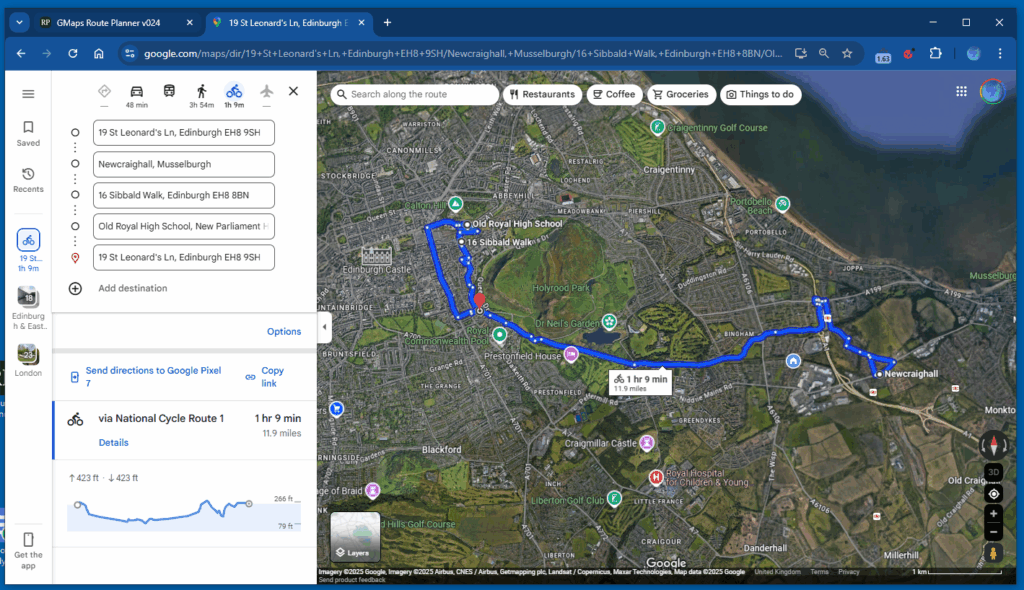
To see the whole route click on Open_Route_in_Google_Maps and here is what it produces (here manually switched to bike). There is an option to email the link. It also creates individual links for each destination so that if for some reason you decide you want to skip a destination, you can. It also allows for the removal of individual destinations and for the alteration of the order of destinations.
And this is what it appears like in a default email program