It is February 2019 and I had written about using pgrouting to display the shortest distance between 2 points on a network using Postgres and the Ordnance Survey Network on my blog CloudyDataBlog.net. Now in 2025 truth be told I had never used this in anger but wanted to revisit the topic and see if I could get it working again. Important for me developments since then.
- I am now a lot slicker at creating database dumps so I am wanting to create a personal library of useful database as templates.
- My newer blog format has better support for embedded code and allows me to explain the concepts better.
- AI is better and quicker at formatting that code making it more readable.
- I wanted to use the open source ordnance network for the whole of mainland Britain and tentatively test the performance of my shortest route implementation.
Steps-
1.Go to Ordnance Survey Data Hub and get the free UK Network
And the specific one you are looking for is… I chose to download the GEOPACKAGE option
osdatahub.os.uk/downloads/open/OpenRoads
2. Create the database ready to import the Open Source Data download into
CREATE DATABASE db005osopennetwork;
CREATE EXTENSION postgis;
CREATE EXTENSION pgrouting;3. Import Geopackage into your newly created database
I had some difficulty getting my download into postgres – with the dump file its not totally necessary to repeat but for reference see immediately below.
I didn’t write it down at the time but the successful option was to export to an SQL file oproad_gb.gpkg and then import oproad_gb.sql into a postgis enabled database. Of course I created db005osopennetwork before hand and installed postgis plugin. Remember the following is command line.
ogr2ogr -f "PGDUMP" oproad_gb.sql C:/gpkg/oproad_gb.gpkg
psql -h localhost -p 5435 -U postgres -d db005osopennetwork -f oproad_gb.sql
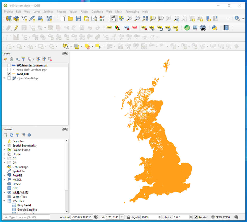
4. Check that the road_link network has been successfully imported
Link to QGIS and display
5. Clean up the road_link table.
The following SQL may not have been strictly necessary but I had made reference to them in 2019 so I wanted to make sure I did the same things. I will go back and try to determine whether they are necessary or not
Strip out z coordinates.
UPDATE road_link
SET geometry = ST_Force2D(geometry);Add identity key if one does not exist.
ALTER TABLE road_link
ADD COLUMN id INT GENERATED ALWAYS AS IDENTITY PRIMARY KEY;Next alter the column variable type named length from double precision to numeric. Without this alteration I was getting pgr_createTopology failure.
ALTER TABLE road_link
ALTER COLUMN length SET DATA TYPE numeric;I then went and added further columns and built a topology using the following commands
ALTER TABLE public.road_link ADD COLUMN source integer;
ALTER TABLE public.road_link ADD COLUMN target integer;
ALTER TABLE public.road_link ADD COLUMN agg smallint default 1;
SELECT pgr_createTopology('public.road_link', 0.0001, 'geometry', 'id');Note the pgr_createTopology took a significant amount of time to execute, about an hour on the whole of the UK on the computer I used It created a further table called road_link_vertices_pgr. I use this later to identify where to measure between.

6. CREATE TABLE to hold the Shortest Route in
Called here t005shortestopathresult
-- Table: public.t005shortestpathresult

-- DROP TABLE IF EXISTS public.t005shortestpathresult;

CREATE TABLE IF NOT EXISTS public.t005shortestpathresult
(
    path_id integer,
    source_node integer,
    target_node integer,
    edge_cost numeric,
    geom geometry
)

TABLESPACE pg_default;

ALTER TABLE IF EXISTS public.t005shortestpathresult
OWNER to postgres;7. Create Necessary Functions to measure distance
The first creates a function that does the measurement taking the parameters source_id and target_id – which can be identified by displaying the road_link_vertices_pgr and labelling up the id field.
The second inserts the records into table t005 so that we can see it later on.
1st Function
-- FUNCTION: public.shortest_path_function(integer, integer)

-- DROP FUNCTION IF EXISTS public.shortest_path_function(integer, integer);

CREATE OR REPLACE FUNCTION public.shortest_path_function(
	source_id integer,
	target_id integer)
    RETURNS TABLE(path_id integer, source_node integer, target_node integer, edge_cost numeric, geom geometry)
    LANGUAGE 'plpgsql'
    COST 100
    VOLATILE PARALLEL UNSAFE
    ROWS 1000

AS $BODY$
BEGIN
    RETURN QUERY
    SELECT
        edge.id,
        edge.source,
        edge.target,
        edge.length AS cost,
        edge.geometry
    FROM
        pgr_dijkstra(
            'SELECT id, source, target, length AS cost FROM public.road_link',
            source_id,
            target_id,
            directed := false
        ) AS path
    JOIN
        public.road_link AS edge
    ON
        path.edge = edge.id;
END;
$BODY$;

ALTER FUNCTION public.shortest_path_function(integer, integer)
OWNER TO postgres;2nd Function inserts constituent lines into table – we could go on to add all the line lengths together to get us a distance measurement. Here simply display the table to have a sense check on the route.
-- FUNCTION: public.insert_shortest_path_result(integer, integer)

-- DROP FUNCTION IF EXISTS public.insert_shortest_path_result(integer, integer);

CREATE OR REPLACE FUNCTION public.insert_shortest_path_result(
	source_id integer,
	target_id integer)
    RETURNS void
    LANGUAGE 'plpgsql'
    COST 100
    VOLATILE PARALLEL UNSAFE
AS $BODY$
BEGIN
    -- Truncate the t005shortestpathresult table to remove all existing records
    TRUNCATE TABLE public.t005shortestpathresult RESTART IDENTITY;

    -- Insert values into the t005shortestpathresult table
    INSERT INTO public.t005shortestpathresult (path_id, source_node, target_node, edge_cost, geom)
    SELECT
        path_id,
        source_node,
        target_node,
        edge_cost,
        geom
    FROM
        shortest_path_function(source_id, target_id);
END;
$BODY$;

ALTER FUNCTION public.insert_shortest_path_result(integer, integer)
OWNER TO postgres;And to run new points simply run the following Select substituting out the nodes you wish to measure between
SELECT public.insert_shortest_path_result(1509247, 995454);Which gives the following result
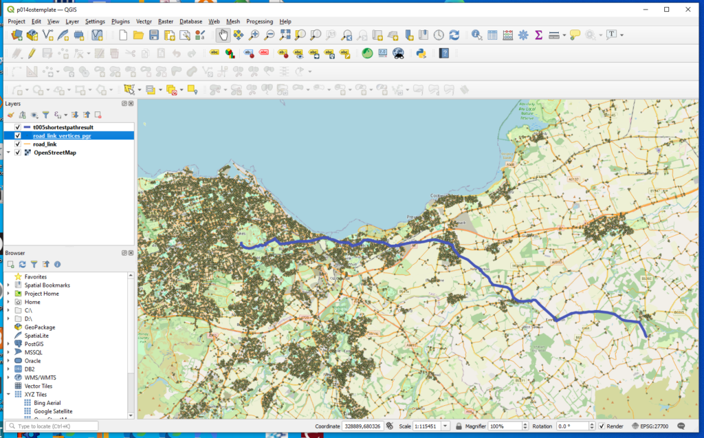
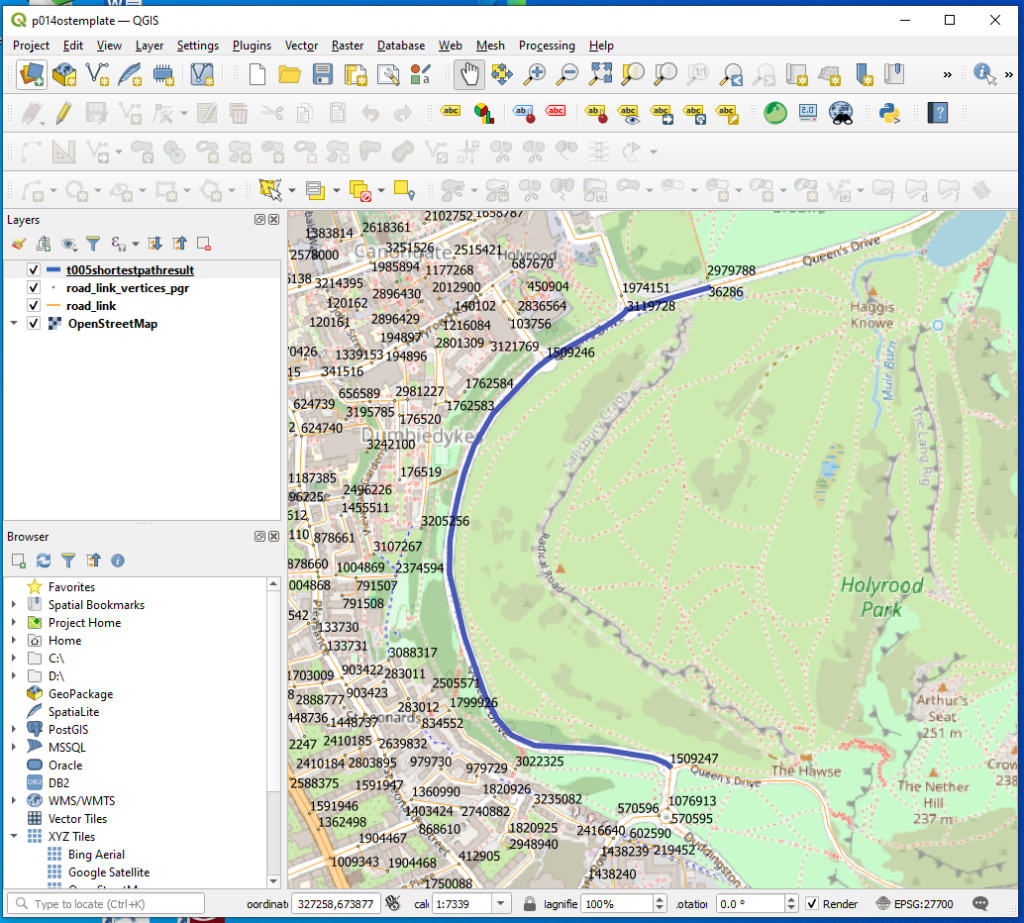
And here is a very short measurement to demonstrate where I get the numbering of start and end
SELECT public.insert_shortest_path_result(1509247, 36286);On my computer for this database it is taking about 20 seconds to measure a distance. From my limited testing this duration does not seem to differ whether its a long or a short distance.
8. pg_dump_template
Finally once I had this working I made a database template dump of the working database with working functions and saved it in the cloud for security. It is named
db_template001_march2025_pg16_uk_osroad_link_shortest_route_measurement.dump
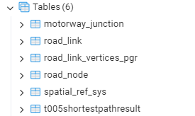
Tables look like this