I thought it would be useful to have a simple application that could create simple location plans for more accurate site locations.
Its not perfect and its certainly not as good as a location plan created by an architect but it is immediately available through a browser and it is purely focused on location plans for planning applications. Based around the Map Libre framework with in this instance an Open Street Map background. Open Street Map quite often doesn’t have fence boundaries between properties which is an issue that would make an Ordnance Survey background better although that comes with copyright issues. In principle Ordnance survey background could be swapped out for this. Depending on the location some authorities might accept this as a location plan. If you were a householder you could for instance register with Open Street Map and directly improve the basemap say to include fence lines and which should then display in this application. With fence lines I would have thought all authorities would consider this as adequate evidence for location map submission as part of a planning application. Here is a previous post where I documented my first efforts to edit the underlying map OpenStreetMap: Participation is easy
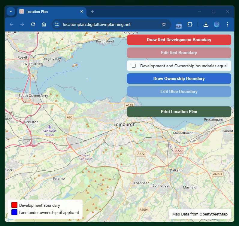
Features
- Create development boundary
- Create separate ownership boundary
- Automaticaly list and show development and ownership boundary as the same
- Editing of both types of boundary after initial definition
- Centres to red boundary on print to pdf
- Black and white background (with colour boundary) on print to pdf
- Calculates development area in metres squared and hectares
- Identifies easting and northings of centre of development boundary
- Scale bar and Compass on pdf
- Legend dynamically changes according to selection
- PDF name stamped with date and time on creation